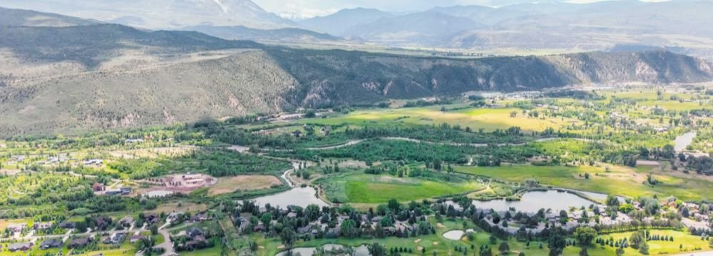
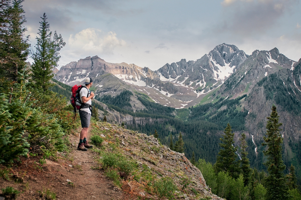
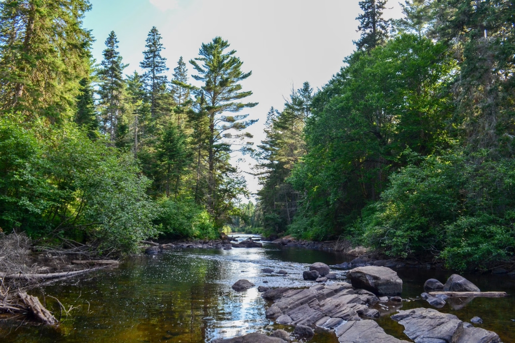
The Roaring Fork Valley is a hiker’s paradise, especially the Aspen trails that lead to beautiful locations and breathtaking views.
As the weathers warms up, locals and visitors alike venture into the mountains to enjoy nature while getting in some physical activity.
What Are the Best Hiking Trails in Aspen, Colorado?
- The best trails for backpacking and overnight camping are Four Pass Loop, which climbs 4 different peaks, and Conundrum Creek Trail, which leads to natural hot springs.
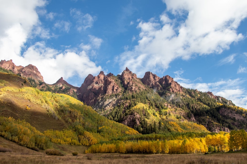
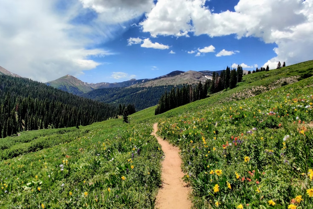
- The best routes with the best views are Cathedral Lake and West Maroon Trail. The trail to Cathedral Lake winds through fields of wildflowers to the shining lake and clear mountain view. West Maroon Trail provides a panoramic view of the surrounding mountains; in the fall, hikers can enjoy the view of golden trees.
Are you looking for a short hike? A long hike? A challenging climb? A relaxing stroll? An unbeatable leaf peeping route?
With so many trails around Aspen, it’s easy to find exactly the type of adventure that you’re looking for.
Read on to learn about the 8 best hikes in Aspen, Colorado.
Table of Contents
- 8 Best Aspen Trails for Hikers of All Skill Levels
- Frequently Asked Questions
- Tips For Hiking in Aspen from the Locals
- Start Your Aspen Adventure Today!
8 BEST ASPEN TRAILS FOR HIKERS OF ALL SKILL LEVELS
Hiking in Aspen is one of the most popular activities during the fall, summer, and spring months. With more than 80 beautiful trails, there’s a route for every type of hiker. However, it’s not always easy to figure out which trails have the best views and will be right for your fitness level. If you need more information about any of the trails listed below, contact Aspen Luxury Concierge.
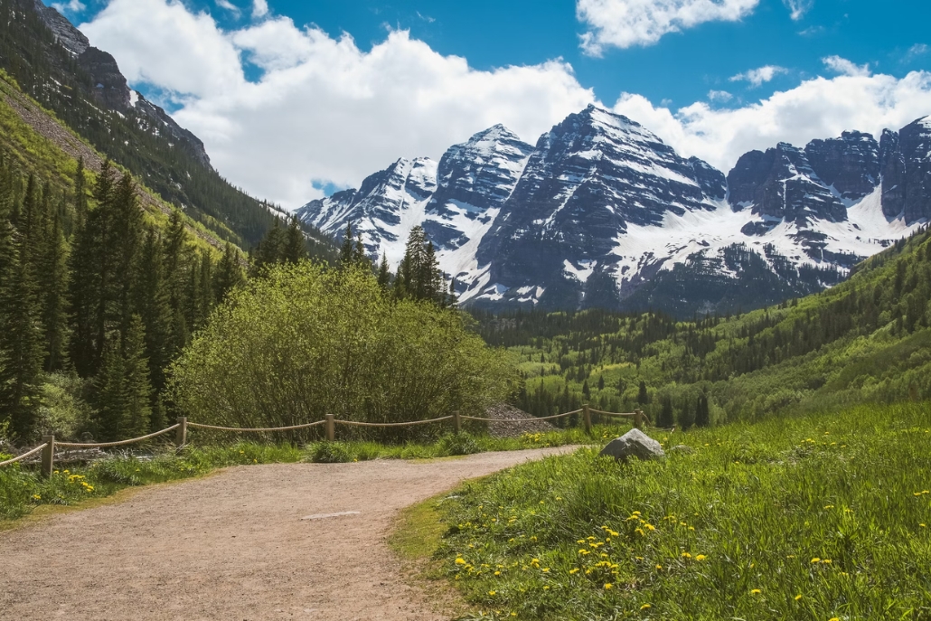
1. FOUR PASS LOOP
This is a well-known backpacking route that winds through the Maroon Bells-Snowmass Wilderness Area.
Hikers start on Maroon Creek Road near the Maroon Bells then can follow the route through the Elk Mountains, over 4 different 12,000 foot peaks, and then end the adventure back at their starting point.
- Length: 26 miles
- Difficulty: Very difficult due to elevation and length
- Elevation gain: 7,752 feet
- Getting there: Maroon Creek Road is closed to private vehicles during the day. If you plan your trip with Aspen Luxury Concierge, then your personal concierge can book your seats on the shuttle or get a car permit for you.
- Logistics: Backpackers must get a permit and carry bear canisters for overnight stays. Camping is only allowed at designated spots. Campfires, dogs, and motorized vehicles are prohibited. All hikers must abide by the Leave No Trace principles.
2. BUCKSKIN PASS
Located near the Maroon Bells Scenic Area, Buckskin Pass is a well-maintained out-and-back trail that is popular among both visitors and locals.
The area is great for bird watching, leaf peeping in the fall, and seeing wildflowers in the summer. Most hikers take 5 to 6 hours to complete the trek.
- Length: 8.2 miles
- Difficulty: Challenging due to rocky conditions
- Elevation gain: 2,916 feet
- Getting there: This trail is located on Maroon Creek Road where cars are not permitted during daytime hours. Let your ALC concierge know if you want to hike this trail, and we will arrange transportation for you.
- Logistics: Hikers are advised to bring bug spray and hiking poles.
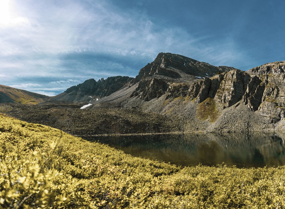
3. CATHEDRAL LAKE TRAIL
This out and back trail takes hikers up to Cathedral Lake: a stunning body of water which, on a clear day, reflects the peaks that tower above it.
For this trek, hikers start at the trailhead, hike to the lake, and then hike back. While the route isn’t as long as other Aspen trails, the hike is steep. Locals recommend wearing hiking boots instead of running shoes.
During certain times of year, the path may be wet, muddy, or icy.
- Length: 5.4 miles
- Difficulty: Challenging due to steep climbs
- Elevation gain: 2,070 feet
- Getting there: The trailhead is about 5 minutes from the ghost town of Ashcroft. There is some parking nearby, but it is best to arrive early to get a parking spot.
- Logistics: Dogs must be on leash at all times. Backpacking and camping are permitted.
4. CONUNDRUM CREEK TRAIL
If you’ve heard of Conundrum Hot Springs, this is the trail that gets you there.
This is an out-and-back route; if done all at once, it takes between 7 and 8 hours to complete.
Most visitors hike out to the hot springs, spend the rest of the day lounging in the 102 degree pools, camp overnight, and then hike back the next day.
- Length: 16.9 miles
- Difficulty: Difficult due to length and stream crossings
- Elevation gain: 2,788 feet
- Getting there: The route is near Aspen Highlands; if you’ve skied the Highland Bowl before, you might recognize some of the landscape. Please note that there is a small parking lot on Conundrum Road; however, it fills up quickly. It is best to start the trek early in the morning.
- Logistics: Anyone camping near the hot springs or in the Conundrum Hot Springs permit zone is required to have a permit, as well as bear canisters. Dogs are not allowed on the trail. Hikers are advised to bring multiple pairs of shoes because shoes frequently get wet and/or muddy while crossing the multiple streams on the route.
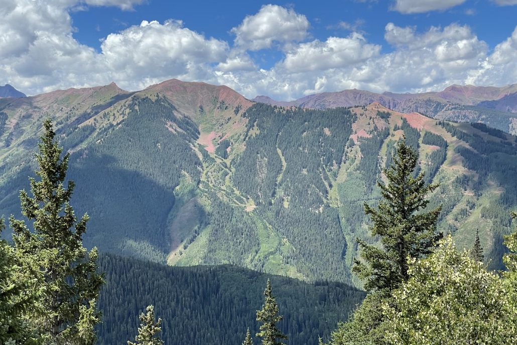
5. WEST MAROON TRAIL
This is one of the longer Aspen trails, running from Aspen to Crested Butte, but the trail is worth going the distance for.
West Maroon Trail is gorgeous in the summer.
Hikers get panoramic views of the mountains as they pass through fields of wildflowers.
Parts of the trail can get steep and technical; however, beginner hikers can still enjoy doing a small section of the trail before turning back.
- Length: 20.6 miles out-and-back
- Difficulty: Very difficult to do the entire route. Certain sections can be manageable for beginners.
- Elevation gain: 5,328
- Getting there: This trail starts in the Maroon Bells area where cars are not allowed on the main road. Talk to your ALC concierge about your different options for getting to the trailhead.
- Logistics: Doing the trek in April is not always advised because the path gets muddy during the spring. Backpacking and camping is permitted as long as visitors leave no trace. Dogs are allowed if they are on leashes.
6. UTE TRAIL
If you want to skip the gondola but still see the view from the Sundeck at the top of Aspen Mountain, then this is the trail for you. It starts at Ute Park and climbs up to Ute Rock, a well-photographed outcropping and popular photo spot.
The uphill climb is brutal on the joints and even the fittest climbers struggle to reach the top.
It is an excellent challenge for anyone looking to prove themselves. Once you reach the Sundeck, you can grab some lunch and give your legs a break.
Gondola rides down the mountain are free, so you can either hike back down via the Aspen Mountain Summer Road for an easier descent or take the gondola.
- Length: 5.3 miles for the entire route out-and-back
- Difficulty: Very difficult due to the elevation climb
- Elevation gain: 3,198
- Getting there: The trail starts at Ute Park, which is a small park on the east side of town. The park is a great place to have an Aspen picnic to fuel up before the adventure.
- Logistics: Locals recommend wearing hiking boots with good tread. Hiking poles can be helpful as well. Bring plenty of water, if you continue past Ute Rock to the top of Aspen Mountain the majority of the trail is in direct sun.
7. HIKE ASPEN MOUNTAIN
Once you reach the summit of Ajax, you have a few options for ways to extend the adventure: either stroll along one of the Aspen trails at the summit or hike down the mountain.
If you want a high altitude hike, check out Richmond Ridge Road, which is an easy 4 mile out-and-back trail. It has incredible views of the entire valley and the Elk Mountain Range.
If you want a change of scenery from the views you saw on the way up, consider taking one of the western trails back down.
Eastern Rim Trail (moderate hike, 1 mile long) connects to Power of 1 (moderate to difficult hike, 2.25 miles long), then takes Little Nell Trail (easy hike, 1.5 miles long) to reach the base.
Please note that these trails are not suitable for beginner hikers. Additionally, it is important to have the right gear to make a hike successful. Many beginner and pro hikers work with Aspen Luxury Concierge to streamline their trip to Aspen. When you work with ALC, our concierges will handle all the gear rentals, trail researching, acquire the proper permits for you, and even run errands to pick up some extra sunscreen. If you’re coming to Aspen for a hiking trip, give Aspen Luxury Concierge a call to see how we can help.
8. SUNNYSIDE & SHADYSIDE
As clear by the names, Sunnyside is the trail that you take if you want to soak up the sun.
Shadyside is a detour trail that winds under a canopy of trees. The first 2-3 miles of Sunnyside is the most challenging because it is a very steep climb with no shade or cover from the heat.
The trail is best climbed in September or October when the trees change color and the temperatures begin to drop.
- Length: 10.8 miles out-and-back
- Difficulty: Very difficult due to the elevation gain
- Elevation gain: 2,683 feet
- Getting there: Located north of Aspen in the White River National Forest, it’s only a 7 minute drive to reach the trailhead. Visitors can park in the parking lot near Henry Stein Park or across from the trailhead in a pullout parking area across from the trailhead off McLain Flats Road.
- Logistics: Like other Aspen trails, conditions may be wet and muddy during spring months. Dogs on leashes are permitted as is trail running and mountain biking.
FREQUENTLY ASKED QUESTIONS ABOUT TRAILS AROUND ASPEN
Aspen is a fantastic hiking location. The Roaring Fork Valley is home to a wide range of hikes at all different lengths, elevation changes, and difficulties. Due to Aspen’s beautiful weather during the spring, summer, and autumn months, hikers can enjoy beautiful mountain views under blue skies.
The Grottos Trail is the easiest of all the Aspen trails. The route is a 0.6 mile loop that is usually pretty crowded. The route takes hikers past waterfalls, along the river, and around huge rocks that can be climbed. The area has ice caves during some times of the year. Brave trekkers may bring a bathing suit for a quick plunge into the clear, chilly river water.
There are 86 different trails around Aspen. The nearby town of Snowmass is home to another 22 hiking, mountain biking, and horseback riding trails.
There are a few different Aspen Mountain trails that take hikers to the summit. The main route is Aspen Mountain Trail, which is 8.8 miles out-and-back (4.4 miles from base to peak) and typically takes 6 hours to complete (3-4 hours for the one-way hike). On the east side of the mountain is Ute Trail, which is a 5.3 mile out-and-back hike, which takes 4-5 hours to complete
The hardest hike in the area is an Aspen Snowmass trail, which takes climbers up Maroon Peak. As one of the fourteeners in Colorado, this trail can only be done by very experienced and expert climbers. The journey is 10.9 miles long with an elevation gain of 4,963 feet. The trek requires technical skill to navigate the terrain, along with stamina, and the speed to get back below the treeline before afternoon storms roll in.
TIPS FOR HIKING IN ASPEN FROM THE LOCALS
Before you set off for yourtrek, there are 3 things that Aspen Luxury Concierge wants new hikers to know:
THE RIGHT GEAR MAKES ALL THE DIFFERENCE:
Before your trip, invest in a good pair of hiking shoes (traction is vital and sneakers won’t cut it on certain climbs), waterproof socks, hiking poles, hydration backpack, sun protection, and breathable layers of clothing.
CHECK THE WEATHER TWICE:
While Colorado is usually very sunny, the weather can change fast. Afternoon storms can roll in before you know it. Check the conditions on the trail and pack extra layers just in case.
BEWARE OF ALTITUDE:
Aspen is 8,000 feet above sea level. That’s the altitude before you climb any mountains. Visitors often experience some altitude sickness when they first arrive. When you’re hiking, make sure to stay hydrated, take it slow, take lots of breaks, and don’t be afraid to turn around. ALC recommends that visitors start with smaller hikes at lower altitudes, then work their way up to the bigger climbs.
START YOUR ASPEN ADVENTURE TODAY!
Aspen Luxury Concierge is a local lifestyle management firm that specializes in providing clients with incredible bespoke experiences during their trip to Aspen.
In addition to giving you trail recommendations and arranging for private transportation to the trailhead, your ALC concierge can make you a post-hike dinner reservation. ALC is here to help you fall in love with Aspen through our impeccable service.
Contact Aspen Luxury Concierge to learn how we can make this the best trip of your life!

 Twitter
 LinkedIn
 Reddit
 Tumblr
 Pinterest